Netravati Trek Guide: Route, Distance, Difficulty, Permit & Best Time
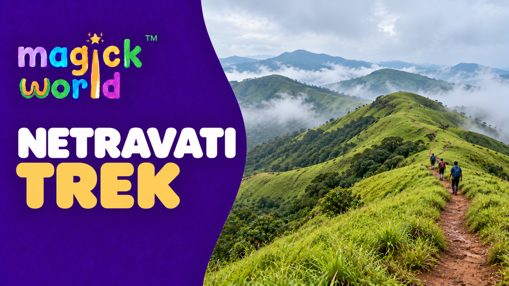
The photographs make the Netravati trek look like an easy walk across green hills. The part they leave out is the planning: which village leads to the trail, how far you actually walk, and whether a forest permit is available for your date. This guide answers those questions for the Netravati Peak trek near Samse in Karnataka’s Chikkamagaluru district. You will also find a realistic day plan, seasonal advice, and a comparison with the Kudremukh trek.
Check before making travel plans: The Karnataka Forest Department’s Aranya Vihaara portal controls current trek availability and bookings. A route described as open in an older article may still be closed on your chosen day because of weather, fire risk, or forest orders. The booking rules below were checked on 26 September 2026.
Netravati trek at a glance
| Question | Practical answer |
|---|---|
| Where is it? | Near Samse and the Kudremukh range, in the Chikkamagaluru region of Karnataka’s Western Ghats. Karnataka Tourism lists the Netravati Peak trek among the area’s regulated trails. |
| Where do you start walking? | At the permitted forest checkpost or trailhead reached by local jeep from the Samse side. Confirm the reporting point shown on your booking; Samse village itself is usually not the walking start. |
| How far is the walk? | There is no consistent published figure. IndiaHikes’ documented trail measures 6.4 km return from its forest-office start; several commercial itineraries quote 12–14 km return. Ask which trailhead and walking route your permit and local guide use, and leave time for the longer estimate. |
| How long should you allow? | A full trekking day: roughly 6–8 hours for walking, stops, checkpost formalities and changeable conditions. The drive from Bengaluru is additional. |
| How hard is it? | Moderate for someone comfortable walking uphill for several hours; harder in sustained rain. The final grassland ascent and wet descent usually demand the most care. |
| Do you need a permit and guide? | Yes. Reserve through the forest booking system, carry the original ID used to book, and follow the checkpost’s guide allocation and entry rules. |
| Best time? | October to February is generally the more forgiving choice. Monsoon greenery comes with slippery ground, mist and possible closures. |
Netravati, Netravathi and Nethravathi are spelling variants used for the same peak trek. Netravati Peak trek is the clearest term to use when comparing guides. It is a different route from the Kudremukh Peak trek, even though both are discussed under Kudremukh National Park. The trek is a day hike; a Bengaluru weekend itinerary takes longer because of the road journey.
Route, starting point and the confusing distance figures
Getting to the trailhead through Kalasa and Samse
For most travellers, the approach is Bengaluru → Kalasa → Samse → forest checkpost by jeep → Netravati trail. Samse is roughly 14 km from Kalasa by road according to IndiaHikes’ route guide. If you arrive by bus in Kalasa, allow time to find a local connection to Samse and arrange the last jeep transfer. Do not assume a regular car can cover the rough final approach. Confirm your exact jeep pickup and forest reporting point before setting out; they may differ from a map pin marked “Netravati Peak.”
Although the trek is commonly described as being in Chikkamagaluru district, IndiaHikes’ booking guide places the Netravati permit under “Dakshina Kannada” in the portal’s district selector. If searching Chikkamagaluru produces no Netravati listing, check that selector; use the label actually displayed by the official portal on the day you book. This administrative detail does not change the usual Kalasa–Samse road approach.
For geographic orientation, view the Netravati Peak area on OpenStreetMap. This marks the peak vicinity, not your authorised trailhead or a substitute for your guide’s route.
What the walk is like
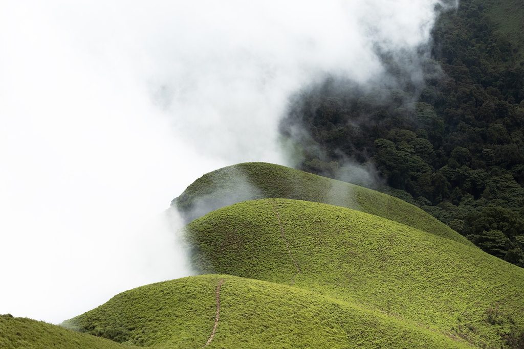
The documented Samse-side route has three useful landmarks. You leave the forest office on a stony, rising path and reach a two-tier waterfall. The middle section passes a canal and a stream crossing, with forest cover and occasional openings towards the surrounding hills. After the stream, the trail climbs into open grassland; several rises can look like the summit before the final steeper pull. You return by the permitted route. IndiaHikes’ route description gives approximately 0.8 km, 1.2 km and 1.2 km for those three outward sections, adding up to its 6.4 km return measurement.
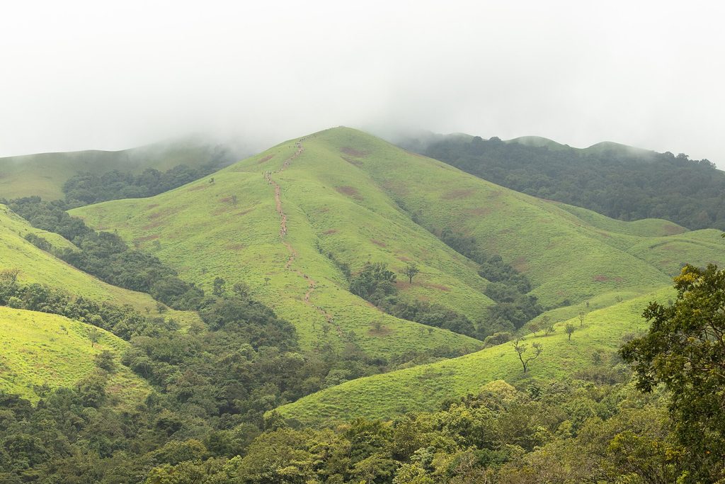
So is the Netravati trek 6 km or 12 km? Both figures appear in widely viewed guides. IndiaHikes measures 6.4 km return from its documented forest-office route, while Plan The Unplanned gives 12 km and Escape2Explore about 14 km. These pages do not provide a common, official route measurement, so the cause of the discrepancy cannot be settled from published descriptions alone. Before you book transport or judge your fitness, ask the guide or organiser: “Where do we start walking, what is the round-trip walking distance from that point, and when must we be back at the checkpost?”
The route passes water, but do not rely on a stream being safe to drink or available in every season. Carry your own water; treat any water you collect. In heavy rain, let the guide decide whether a crossing is safe. A good view from the summit also depends on cloud and visibility, not just the month printed on your itinerary.
Netravati trek permit, booking, entry fee and total cost
How to book the forest permit
- Open the official Aranya Vihaara trekking portal and sign in or register.
- Use Search Trek Availability to select the district, the Netravati/Nethravathi trek and your proposed date. Check Dakshina Kannada if Netravati is missing under Chikkamagaluru, then follow the portal’s current listing.
- Enter each trekker’s details accurately using the identification requested in the booking flow. Complete the reservation and keep its confirmation or booking ID accessible offline.
- Bring the original identity document used for the reservation to the reporting point. Arrive at least 10 minutes before your allotted slot, and follow any earlier arrival instruction on the ticket or from the forest office.
The portal states that bookings must be made at least one day before the trek and can be made up to 30 days ahead. Its rules effective 15 July 2026 say that cancelling eight or more days before the trek returns 50% of the amount paid; cancelling within seven days, including day seven, brings no refund. A package operator may have a separate cancellation policy. Check the current notice and the terms on your own booking before paying. The portal lists a forest help line, 1926, for booking assistance. Source: Karnataka Forest Department, Aranya Vihaara.
A permit reservation is not a reason to enter a closed trail. Recheck the portal’s availability and announcements shortly before travel, especially during heavy rain or the dry-season fire-risk period. Karnataka Tourism says camping in the park is not permitted and that trekking charges and guide charges are separate.
What should you budget?
The Kudremukha National Park tariff page publishes ₹500 per person for the Nethravathi Peak trek and ₹1,000 for a guide for a group of up to ten. It also says reservations and a guide are compulsory. Treat these as a published tariff, not a guaranteed final checkout total: confirm the permit price, payment method, guide allocation and any added charges in the current booking flow or at the forest checkpost. Do not confuse this forest charge with a Bengaluru transport package.
Budget separately for your Kalasa–Samse connection, return jeep to the trailhead, water and packed food, and travel from your starting city. Jeep quotes in trek guides vary by group and season; get the full return vehicle price and seating capacity before accepting it. If an organiser says “permits included,” ask for your booking confirmation, whose name is on it, and what happens if the forest department suspends entry. Booking a transport package alone does not secure a forest slot.
Difficulty and best time for the Netravati Peak trek
Is Netravati suitable for beginners? Yes, for a beginner who has walked hills before or prepared for several hours of ascent and descent, provided the trail is open and conditions are reasonable. It is not a technical climb, but “beginner friendly” should not mean effortless. The wet forest path, stream crossing and long grassland climb can slow a group considerably. A first-time trekker with weak footwear or little walking fitness may find the descent harder than the ascent.
| Season | What changes | Sensible choice |
|---|---|---|
| October–February | The hills can remain green after the rains, with a better chance of clear views and firmer footing. | The most practical window for a first attempt, subject to a confirmed permit. |
| June–September | Deep green grasslands and moving clouds, but heavy rain, leeches, slippery rock and possible high stream flow. | Go only if the forest has opened your date and your group is equipped for wet conditions; expect the guide to turn back if needed. |
| March–May | More exposed, warmer and often drier; fire precautions can affect access. | Check the portal before building a trip around the trek. Do not assume it runs throughout the year. |
Karnataka Tourism favours October to March for the wider park and warns that June–September trails are slippery. That is more useful for a new trekker than a blanket claim that the monsoon is “best”: choose the season for the conditions you can safely manage, and confirm that your date is bookable.
Bring shoes with reliable grip, a rain layer, a small first-aid kit, snacks in reusable packaging, and enough drinking water for the whole walk; around 2 litres per person is a sensible starting amount, with more if you usually drink heavily or expect heat. Keep a dry layer and your ID in waterproof protection. Network coverage can be patchy; share your plan with someone before leaving. Stay with the assigned guide, bring back all waste, and do not walk an unapproved shortcut to a viewpoint.
Netravati trek from Bangalore: a weekend plan that leaves room for delays
The Bangalore to Netravati trek journey is commonly routed through Kalasa and Samse, about 320–330 km to this region by road, depending on the starting point and route. Do not use the distance to Chikkamagaluru city as a proxy for the trailhead. A night bus or overnight road trip gets you near Kalasa; the local connection and jeep still take time. A relaxed schedule is more reliable than promising a summit immediately after a late arrival.
| When | Plan |
|---|---|
| Before departure | Secure a named forest booking, check the chosen slot and forest notices, and confirm how you will reach Samse and the checkpost. |
| Friday night / travel day | Travel from Bengaluru towards Kalasa. Allow extra time for road and weather delays. |
| Trek morning | Continue to Samse, take the arranged jeep to the reporting point, show the booking and original ID, and meet the guide. Start at the time permitted by the forest staff. |
| During the day | Walk to the summit only if the route and weather allow; turn back with enough daylight to descend and meet the checkpost’s return deadline. |
| Return | Allow time for the jeep and road connection back to Kalasa before committing to a Bengaluru departure. Keep a flexible buffer in wet weather. |
This is a one-day trek, even when a marketed “Netravati weekend trek from Bangalore” occupies two or three calendar days. Ask whether a quoted package includes the forest fee, compulsory guide and last-mile jeep, or only the intercity journey. For a self-planned trip, the forest booking and checkpost reporting time should determine your transport choices.
Netravati trek vs Kudremukh trek
| Decision point | Netravati Peak | Kudremukh Peak |
|---|---|---|
| Usual access | Kalasa → Samse → jeep → assigned forest start | Kalasa → Mullodi → forest start |
| Walking distance | Disputed: 6.4 km in one documented route; 12–14 km in several operator itineraries | About 20 km return in Karnataka Tourism’s guide |
| Trail feel | Forest, waterfall/stream section and a grassland finish with successive rises | A longer day through forest and rolling grassland to the horse-shaped summit |
| Effort | Generally less walking than Kudremukh on the commonly described routes, but still a substantial climb; rain raises difficulty | A longer full-day walking commitment, even for fit beginners |
| Permission | Check the Netravati listing and slot on Aranya Vihaara | Check the separate Kudremukh listing and slot on Aranya Vihaara |
If you want a shorter introduction to the area and your guide confirms a manageable Netravati route, Netravati may suit you better. If a longer walking day is the point of the trip, consider Kudremukh. Neither summit view is guaranteed in mist, and a permit for one trek does not cover the other. The forest staff’s instructions outweigh any itinerary found online.
Frequently asked questions
How long is the Netravati trek?
Allow a full day for the trek and checkpost formalities. Published walking distances conflict: IndiaHikes documents 6.4 km return, while several organisers quote 12–14 km. Ask where your group actually begins walking and allow about 6–8 hours for the outing.
Where is the Netravati trek starting point?
Travellers usually approach through Kalasa and Samse, then take a local jeep to the forest checkpost or permitted trailhead. The peak pin on a map is not the reporting point. Follow the location on your confirmed booking and check it with your jeep driver or guide.
Is a permit required for Netravati Peak?
Yes. Check availability and reserve through the Karnataka Forest Department’s Aranya Vihaara portal. Bring the original ID used in the booking and comply with the allocated guide and reporting slot. No available ticket means you should not set off for the trail.
What is the Netravati trek entry fee?
The park’s published tariff lists ₹500 per trekker, with a separate ₹1,000 guide charge per group of up to ten. Check the actual price and payment instructions when you book; last-mile jeep hire and travel from Bengaluru cost extra.
What is the best time for the Netravati trek?
For a first visit, aim for October to February if permits are available. The monsoon can be beautiful, but wet rock, high streams and poor visibility make it more demanding. Trail access can change at short notice, so check the official portal just before leaving.
Before you leave: Confirm your named permit, exact checkpost, guide arrangements and return time. Then pack for a full day outdoors. If you are planning other walks in the region, read the related Chikmagalur and Kudremukh guides to decide which route matches your fitness and travel time.